Cutting-edge drone technology delivers centimeter-accurate topographic data for trail design, land planning, and site analysis. See your terrain like never before.
High-resolution RGB imagery processed into detailed 3D models, orthomosaic maps, and digital elevation models. Perfect for visual site analysis and detailed texture mapping.
Laser-based 3D scanning that penetrates vegetation to map ground surface and forest structure. Essential for heavily wooded trail corridors and precise elevation data.
Ultra-high-resolution RGB photographs providing visual context for every inch of your property
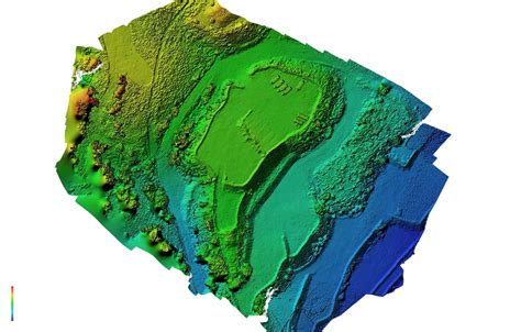
Digital elevation models (DEM) and digital surface models (DSM) for slope analysis and trail routing
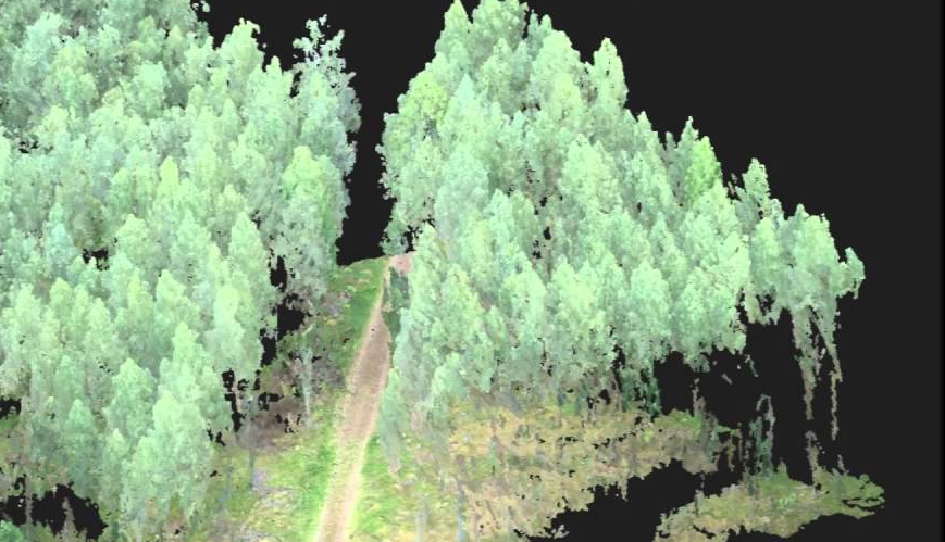
Millions of georeferenced 3D points capturing every feature—rocks, trees, terrain undulations
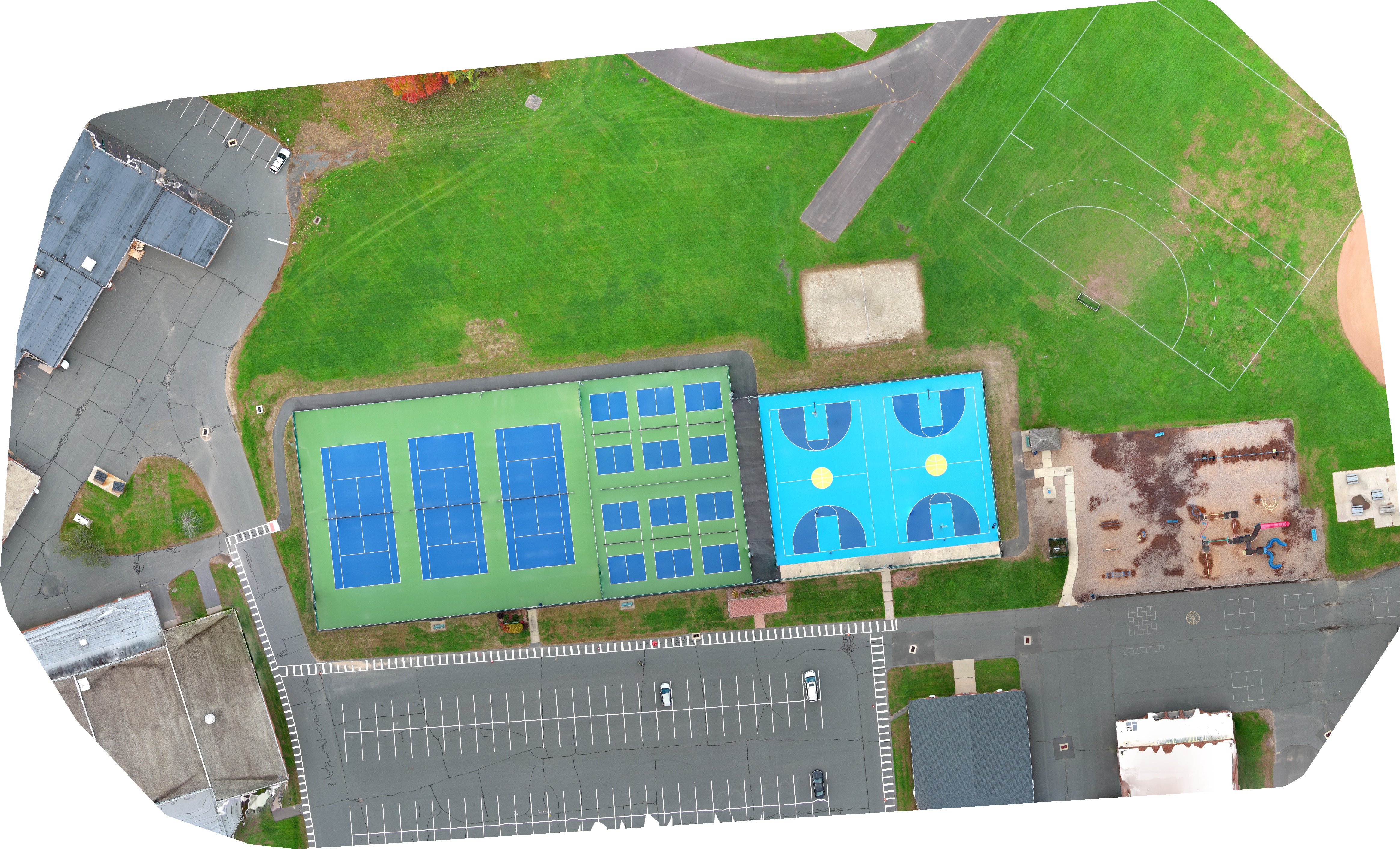
Geometrically corrected, seamless aerial maps perfect for GIS integration and precise measurements
How aerial mapping transforms your trail development process
Survey hundreds of acres in hours, not weeks. Get your project moving faster than traditional ground surveys.
Analyze slope gradients, drainage patterns, and sight lines to design trails that ride perfectly and minimize erosion.
Reduce surveying costs by 50-70% compared to traditional methods while gaining superior data quality.
Assess vegetation, identify sensitive areas, and plan sustainable corridors without disturbing delicate ecosystems.
Present stunning 3D visualizations to planners, funders, and community members—making complex concepts tangible.
Monitor trail conditions over time, track erosion, measure construction progress, and document maintenance needs.
Design flowy singletracks, technical descents, and jump lines with precise elevation data. Analyze grade reversals for drainage and optimize berms using exact contour mapping.
Plan progressive feature zones, pump tracks, and jump progressions. Accurately calculate cut-and-fill volumes for earthwork budgeting before breaking ground.
Route sustainable paths through varied terrain, identify viewpoints and rest areas, and ensure ADA-compliant grades for accessible sections.
Leverage existing infrastructure with precision mapping of ski runs, service roads, and lift corridors to design year-round recreation opportunities.
Map sensitive habitats, delineate conservation zones, and design low-impact trail corridors that protect ecosystems while providing public access.
Let's discuss how aerial mapping can elevate your trail project. Get a custom quote.